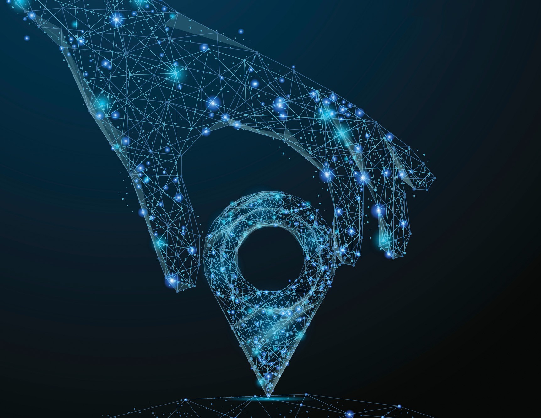
What3Words
The American physicist and future philosopher Michio Kaku has presented a special awareness level model. This includes only the three stages: spatial awareness, social awareness, preconcitive awareness. Already very simple creatures – starting with the insects and reptiles – are able to orient themselves in space, but at least in the area. For every species, including humans, it is important to orient themselves in their spatial environment, to seek protection, to find food and to find partners willing to mate.
Natural peoples have always oriented themselves to natural brands such as rivers, mountains, trees, etc. Sometimes these have become spiritual places – like the holy mountain Kailash in Tibet. With urbanization, it was no longer easy to refer to natural resources. This is no longer possible today. In a city with millions of houses, another system is needed.
Great inventions of the Renaissance such as compass, map and sextants have technologized the navigation. With these still very simple systems it was already possible to measure the world largely. In his novel “Surveying the World”, Daniel Kehlmann describes two very different approaches against the backdrop of the two natural scientists Carl Friedrich Gauss and Alexander von Humboldt. While Gauss approaches the problem purely mathematically, Humboldt has made this very empirical through extensive world travels and the resulting recordings.
Another major milestone in surveying the world was set by the satellite location “GPS”. For the time being only for military purposes and in recent decades also for the civilian sector. With satellite-based navigation, it is now possible to navigate the grid of postal addresses. In itself, the accuracy is not very high – is about 10 m. The apparent accuracy arises from the interaction of the satellite signal and the electronic map. If the satellite signal announces the position at about 8 m next to the road, this is corrected by the software on the road. This is enough to meet the requirements for finding buildings.
The coordinates must be much more accurate in the case of land surveying and documentation of infrastructures. Again, in the past, a mechanistic process, in the form of triangulation with mirrors, was used. Today, the satellite signal is used, which is adapted by terrestrial correction stations. This enables accuracies down to the centimeter range. This exact data is required today for the measurement of gas and high voltage power lines and will determine autonomous driving in the future. This high precession also has a drawback: the coordinates are given by latitude, longitude and altitude. These are three numbers, each with six or more decimal places – so not manageable for humans. The integration of the navigation system with GPS function in the smart phones brings here, of course, a remedy. One thus manages to couple the postal address with the georeference data, without having to memorize multi-digit numbers. Very widespread is the coordinate system WGS84, which was developed with the introduction of GPS services. With that we already have different possibilities to locate a point and these are:
Alias: Taekwondo Zentrum
Name: JUFA Hotel
Adress: Fürstenfeld, Burgenlandstraße 15
WGS84: 47,048687 und 16,083037
What3Words: kurse.fanclub.komme
The latter system with the three words is relatively new. It transforms the WGS84 coordinates into pronounceable words. With 25,000 German words and three digits 25,000^3 = 1,56*10^13 different points can be addressed by mathematical formula.
What3Word has divided the world into 57 trillion 3×3 m squares and assigned each of these squares a unique address using the three words. This can also identify objects that are not provided by street name and house number. It can be used to address yurts in Mongolia as well as hunting high seats and tin sheds in slums. Due to the accuracy of the 3×3 m grid, it is also possible to further locate postally addressed properties. For example, you could pretty well tell the garbage collector where the garbage can stands, where to deliver the building material, or where the back entrance is. Delivery companies such as RTT save 35% on delivery costs with W3W and are 44% faster.
If one has agreed on the basic coordinate system according to the WGS84, W3W can be used in different languages. In English, 40,000 words are available for the three digits. This also makes it possible to address all oceans and water surfaces.
Culturally, there is a world wide number of addressing methods. Alone between the European-continental system and the US is not easy to change. The massive influx to big cities (globalization) will probably bring the existing addressing procedures to their limits. With W3W it would now be possible to unify all of these different systems. Although this can not be prescribed, but for practical reasons could arise of its own. Implementation would probably start right where there is no address system – in the steppe, in slums and in new urban metropolises.
Humanity has accurately measured their “prison”. Since Einstein’s times, the space-time continuum is known, which is hardly possible to leave according to today’s physical findings. Although, with very fast aircraft and rockets, time can be influenced in the microsecond range. Time, and therefore the room is very stable. It is not even possible to overcome this limitation on a spiritual level. The human mind can not think more than the sensory systems pretend. With that you can imagine very exotic planets (science fiction films); but these are based exclusively on images, sounds and touches. We can not imagine a different world of difference and will not bring with it a virtual reality. It is possible to change to other spiritual spaces (otherworlds). For this, however, it requires other, not yet known, qualities of sensory systems. Even hallucinations and drugs do not open our prison.
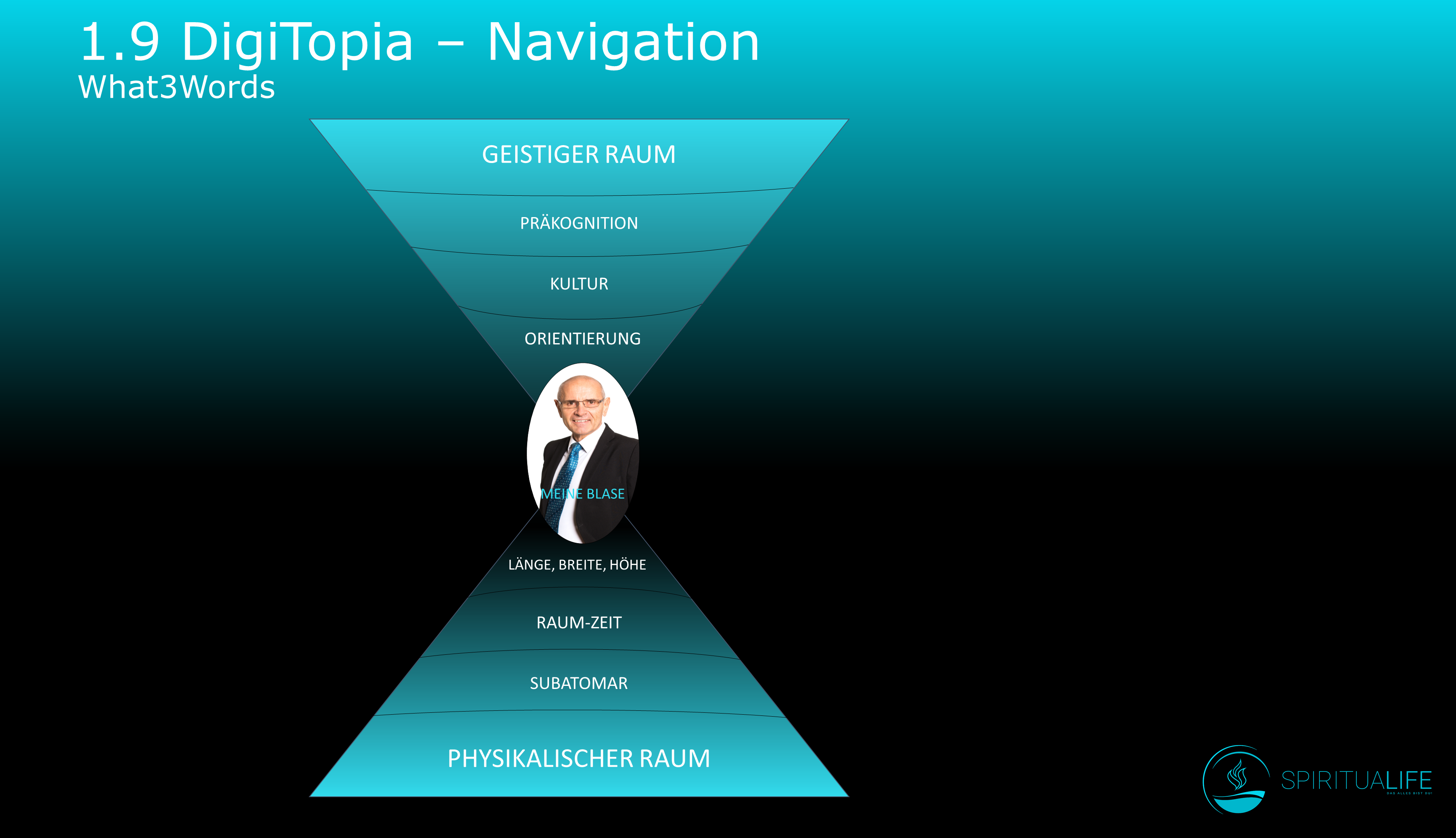
The human brain is most likely able to think more than three dimensions. However, if we do not know what higher dimensions are and what interfaces they enter into the brain, we can not think of them either. So there are three ways to leave the room, these are gravity, speed and consciousness. The above mentioned Michio Kaku only recognizes three levels of consciousness. We may be curious to see if digitization has such a strong influence that it leads to an increase in consciousness.
The German philosopher Peter Sloterdijk already dealt intensively with the spaces from a philosophical point of view in the 1990s. Unfortunately, his books are rather difficult for philosophers to read; There are also hardly any interpretations on Youtube. Nevertheless, for interested readers, the three titles: bubbles, globes and foams. What is missing from Sloterdijk so far is the fourth volume of virtual spaces. Would be nice if there is something else. That would also be a motivation to read the first three volumes (once again).


 Deutsch
 English